
ADVERTISEMENT
ADVERTISEMENT
The Navionics® Boating app is a complete package for cruising, fishing, sailing, diving, and any day you spend on the water. It works as an offline chart companion and a mobile control center.
If you’re looking to Download Navionics® Boating APK or plan a quick Navionics® Boating App Download, the core promise stays the same: get up-to-date detail you can still use when you lose signal.
This free Navionics® Boating app experience starts with internationally known Navionics® charts, plus overlays that help you understand what’s above and below the surface.
You can install Navionics® Boating with offline support, multiple overlay options, daily updates, and a suite of planning tools that turn your phone or tablet into a practical navigator.
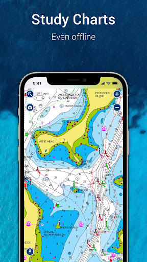
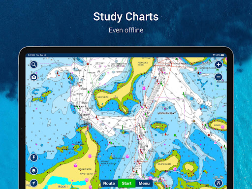
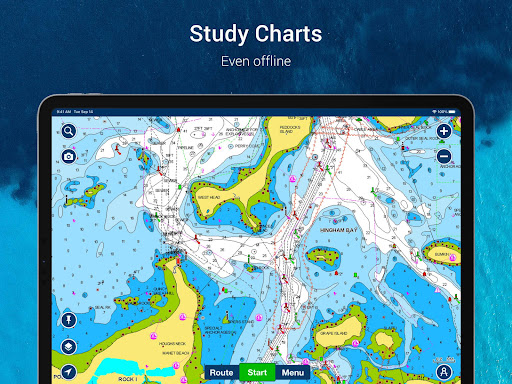
Offline charts and premium mapping. The nautical chart reference includes port plans, anchorages, safety depth contours, navaids, and marine services.
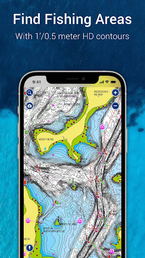
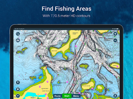
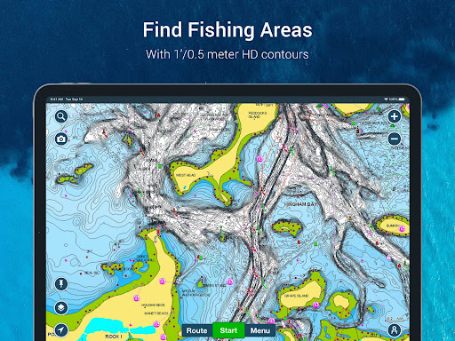
SonarChart™ HD bathymetry maps add extraordinary 1’ (0.5 meter) bottom contour detail, which is ideal for discovering new fishing grounds. Use it comfortably even away from coverage.
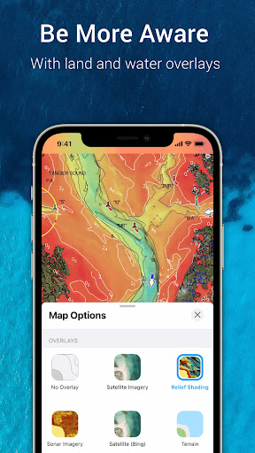
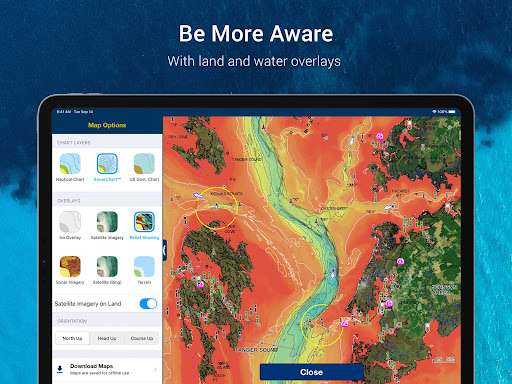
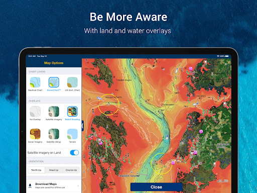
U.S. government charts (NOAA) are included across U.S. and Canada, Mexico, Caribbean to Brazil. Overlays include relief shading for improved understanding of bottom topography.
On select lakes, sonar imagery can show bottom hardness in vivid color, helping you interpret the seafloor faster. You can also overlay satellite imagery on land and water.
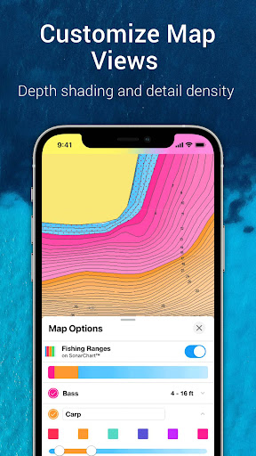
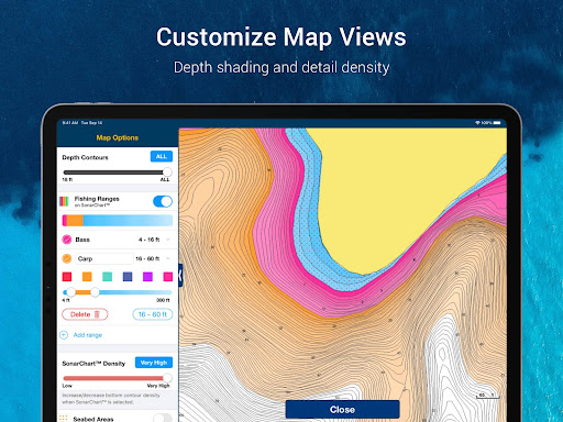
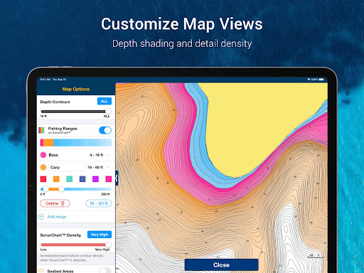
Smart map options for changing conditions. Switch chart and overlay combinations, activate night mode, highlight shallow areas, and tailor views for different fishing ranges.
With thousands of daily updates worldwide, the app can keep your maps relevant. That matters when you plan routes, choose anchorages, or revisit known spots.
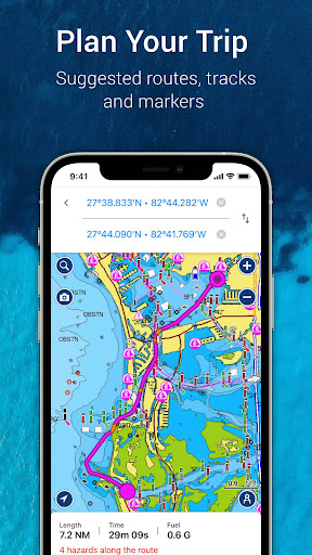
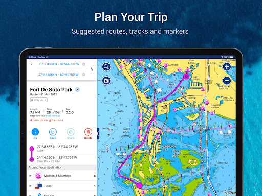
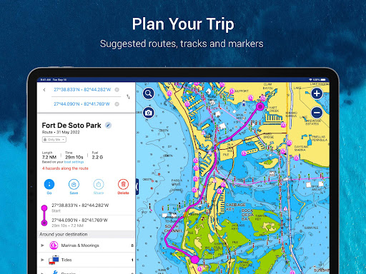
Planning tools that reduce guesswork. Auto Guidance+ technology suggests a dock-to-dock path using chart data and navigation aids. You also get ETA, distance to arrival, heading to waypoint, and fuel estimates.
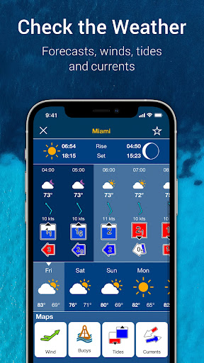
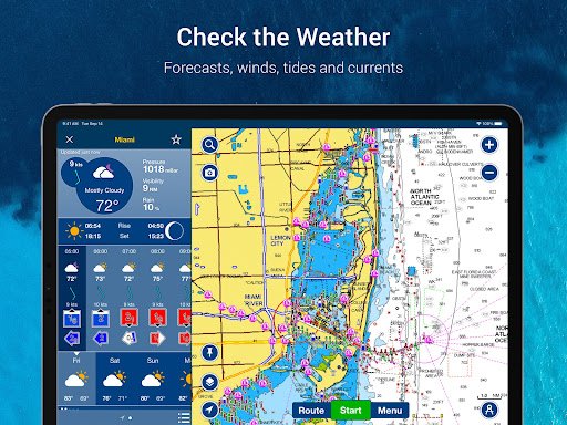
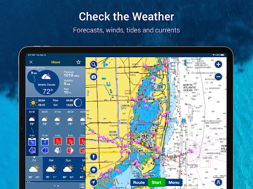
Before you go, check Weather and Tides for real-time data, daily and hourly forecasts, plus wind, buoys, tides, and currents. This helps you time departures and adjust plans.
Markers, tracks, and distance tools let you drop a marker at a good anchorage or a successful fishing location. Record your track and revisit photos or videos later in the app.
You can check distance between two points easily, which is useful for short hops, line-of-sight checks, and measuring routes between waypoints.
Community features for local knowledge. Community edits and the ActiveCaptain® community help you learn from people with firsthand experience, including points of interest, navigation aids, and recommendations.
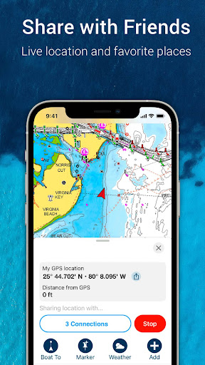
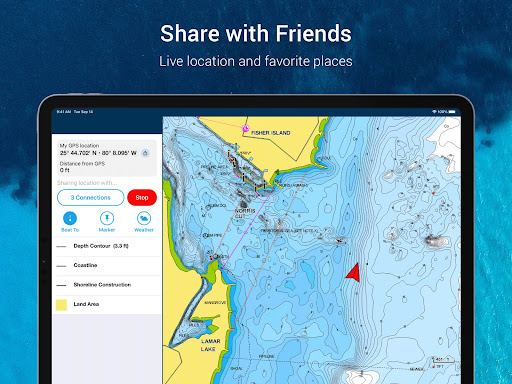
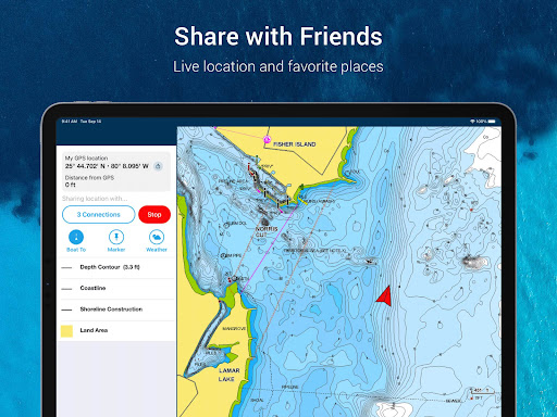
You can share live location, tracks, routes, and markers to meet friends more easily or let others explore your adventures. These are practical features when planning with a group.
Data sharing and device-friendly extras. GPX import/export helps you move saved data outside the app or transfer it to a chartplotter. Share map objects like marinas or repair shops too.
If you choose a Navionics® Boating free download option for a trial period, you can still benefit from these workflows. Many boaters try it first to confirm it fits their routines.
External integrations for advanced setups. Plotter sync can transfer routes and markers and help manage chartplotter card subscriptions, where supported by compatible devices.
SonarChart Live mapping lets compatible sonar/plotter setups create maps in real time while navigating, which is exciting for exploring unfamiliar areas.
For situational awareness, connect to a compatible AIS receiver with Wi‑Fi® connectivity. Set a safe range and receive visual and aural alerts for potential collision risks.
That combination of charts, planning tools, and real-time safety context is why many people search for Navionics® Boating App Download and consider it a daily boating necessity.
Reviewers often highlight how easy it is to use the app offline. They appreciate Download Navionics® Boating APK or the standard install path because charts remain useful even when mobile data is unavailable.
Many comments mention the mapping detail, especially with SonarChart™ HD bathymetry. Users like how contours support fishing decisions and how overlays improve their sense of bottom structure.
People also value the planning side, noting the usefulness of dock-to-dock routing and the clarity of ETA and distance readouts. Several recommend the free Navionics® Boating app trial to test trip planning.
In community feedback, boaters praise the ActiveCaptain® style knowledge exchange. They describe it as a practical way to learn local conditions, including navigation aids and points of interest.
Some users mention that trial discovery is smoother when you install Navionics® Boating early, then save markers and tracks from the first outing. Later, they share GPX data or route details externally.
While most reviews are positive, some users expect integrations to require compatible hardware. Still, they generally feel the app earns its place once plotter sync and AIS support are set up correctly.
Overall, the most consistent theme is confidence: clearer charts, faster planning, and a stronger connection to nearby boating knowledge. That’s why Navionics® Boating free download searches remain common among new boaters.
The app emphasizes ongoing improvement through daily chart updates and continued feature refinement. Users often appreciate that the mapping detail can stay current without constant manual work.
When new functions arrive, they typically strengthen navigation, planning, and community workflows. For example, enhancements to overlays, map options, and data-sharing can make day-to-day use smoother.
Several users who pursue Navionics® Boating App Download for the trial period enjoy watching how the app evolves. They mention improved clarity when switching chart-overlay combinations and night mode.
Updates also support better integration behavior with compatible devices. That matters for anyone aiming to install Navionics® Boating and then rely on plotter sync or live mapping features.
Because daily updates are a major advantage, many people keep coming back after trying the free Navionics® Boating app trial. They want the charts to reflect changes worldwide.
If you’re selecting a Navionics® Boating free download pathway for early access, remember that subscription management can be important for continuing advanced tools beyond the trial.
For the smoothest experience, use a compatible smartphone or tablet that can run the Navionics® Boating app and support offline chart access.
A tablet device with Wi‑Fi connectivity locates your approximate position if connected to Wi‑Fi. A tablet Wi‑Fi + 3G model operates similarly to a phone with GPS.
This means you can often Download Navionics® Boating APK or use the normal installer, then still rely on core mapping when conditions limit connectivity.
For live features like AIS and live mapping, you’ll also need compatible hardware and stable wireless connectivity. Check device compatibility before you plan your next trip.
If you’re preparing a Navionics® Boating App Download for a new device, make sure it meets the app’s current support expectations. This helps avoid delays during installation.
Finally, remember that the app includes offline chart usage, so you can focus on boating rather than chasing signal. That practical design is a big reason users choose this platform.
To share location and support live community features, the app may request location permission. This helps with accurate positioning when you mark waypoints or share tracks.
For AIS workflows and alerts, permission and connectivity settings can be required depending on your device and receiver setup. You may need to review settings before enabling those functions.
If you plan to record tracks, save media, or attach photos and videos to your day, the app may request storage or media access. This keeps your log organized and retrievable.
When you install Navionics® Boating, it’s important to review prompts carefully. Users often recommend matching permissions to your typical use case for safer navigation planning.
For Wi‑Fi based positioning, your device may need access consistent with network location services. This is relevant when you want the app to find your approximate position indoors or near Wi‑Fi.
Note that some free trial experiences still rely on a tablet Wi‑Fi setup to estimate position. Wi‑Fi is a registered trademark of the Wi‑Fi Alliance.
By understanding permissions early, you can get the best from a free Navionics® Boating app trial and keep the app ready for your next cruise, fishing trip, or dive plan.

Welcome to AppSparkle - your independent guide to discovering trending and popular apps. Our mission is to provide a user-friendly platform highlighting popular apps available on official stores.
At AppSparkle, we gather and present app information to help you explore options across Google Play and the Apple Store. Our descriptions are based on public sources and aim for accuracy, but we encourage verifying details directly on official store pages.
Important Notice:
AppSparkle is an independent third-party platform. We are not affiliated with, endorsed by, or officially connected to any app developers, brands, Google Play, Apple App Store, or their parent companies. All app names, logos, and trademarks belong to their respective owners.
We strive to make app discovery straightforward. Links provided will direct you to secure download pages on Google Play or the Apple App Store.


